SurfNeHF UbiComp '26
โ† Back to homepage

SurfNeHF: Surface-Aware Neural Height Fields for Efficient 3D Urban Mapping Using Crowdsourced GNSS Data

Haifeng Jia, Xingyuan Ding, Minyang Qu, Yibo Pi#, Cailian Chen (# corresponding author)
Shanghai Jiao Tong University
Proceedings of the ACM on Interactive, Mobile, Wearable and Ubiquitous Technologies (IMWUT/UbiComp'26) Shanghai Acceptance Rate: 13% (127/955)
01 Crowdsensed Data Collection
02 Reconstruction via SurfNeHF
03 3D Urban Map Export

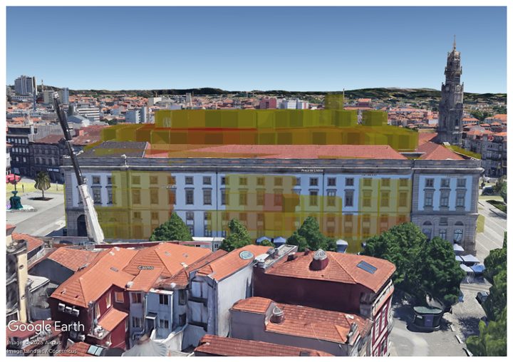
SurfNeHF pipeline: crowdsensed GNSS links, surface-aware neural height fields, and exportable 3D maps.

Abstract

Modern cities increasingly rely on 3D urban maps as digital infrastructures to support applications such as navigation, autonomous driving, urban development, and cellular network planning. Maintaining these maps with high fidelity and timely updates, however, remains challenging due to the high cost and limited availability of aerial imagery or LiDAR data.

In this work, we present SurfNeHF, a lightweight deep learning framework that accurately infers building shapes from noisy crowdsourced GNSS data. By adapting optical inverse rendering to the radio frequency domain, SurfNeHF represents building surfaces as neural height fields and explicitly models signal-surface interactions. This surface-aware formulation enables the framework to effectively disentangle building geometry from surface reflectance and satellite sources, significantly reducing optimization complexity compared to volumetric approaches.

Extensive evaluations demonstrate that SurfNeHF consistently outperforms state-of-the-art methods across diverse urban morphologies. Our framework achieves an average reconstruction accuracy of 94.6% while reducing computational overhead by 80% to 90% compared to baselines. With both higher data and system efficiency, SurfNeHF makes periodic large-scale urban map updates more practically feasible.
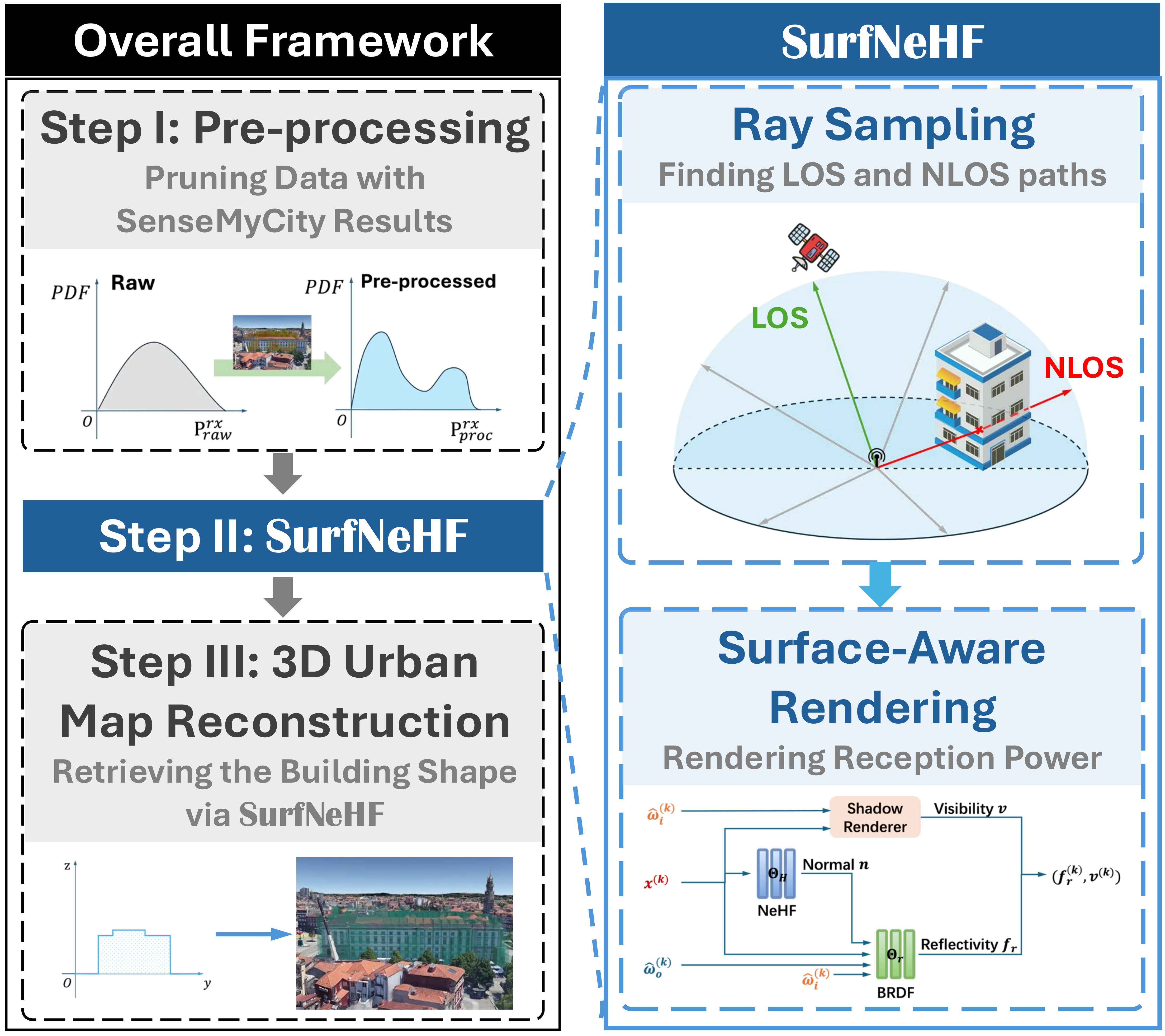
Overview of the SurfNeHF framework

Surface Representation via Neural Height Fields (NeHF)

Instead of densely voxelizing 3D space, SurfNeHF represents building geometry as a continuous Neural Height Field (NeHF) $H:(x,y)\mapsto h$, and couples it with surface-aware ray sampling and RF-domain reflectance modeling.

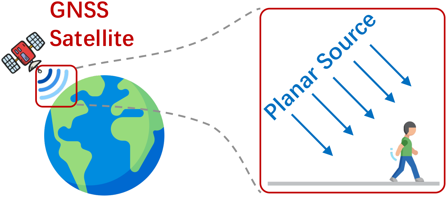
Satellite sources. GNSS satellites act as planar sources relative to a local reconstruction region. Owing to the extremely large transmitter distance, incident rays from each satellite are treated as parallel across the scene. We therefore characterize each source by a shared incoming direction $\hat{\omega}_s$ and a learnable transmit power $P^{\mathrm{tx}}_s$, jointly optimized with NeHF and BRDF.

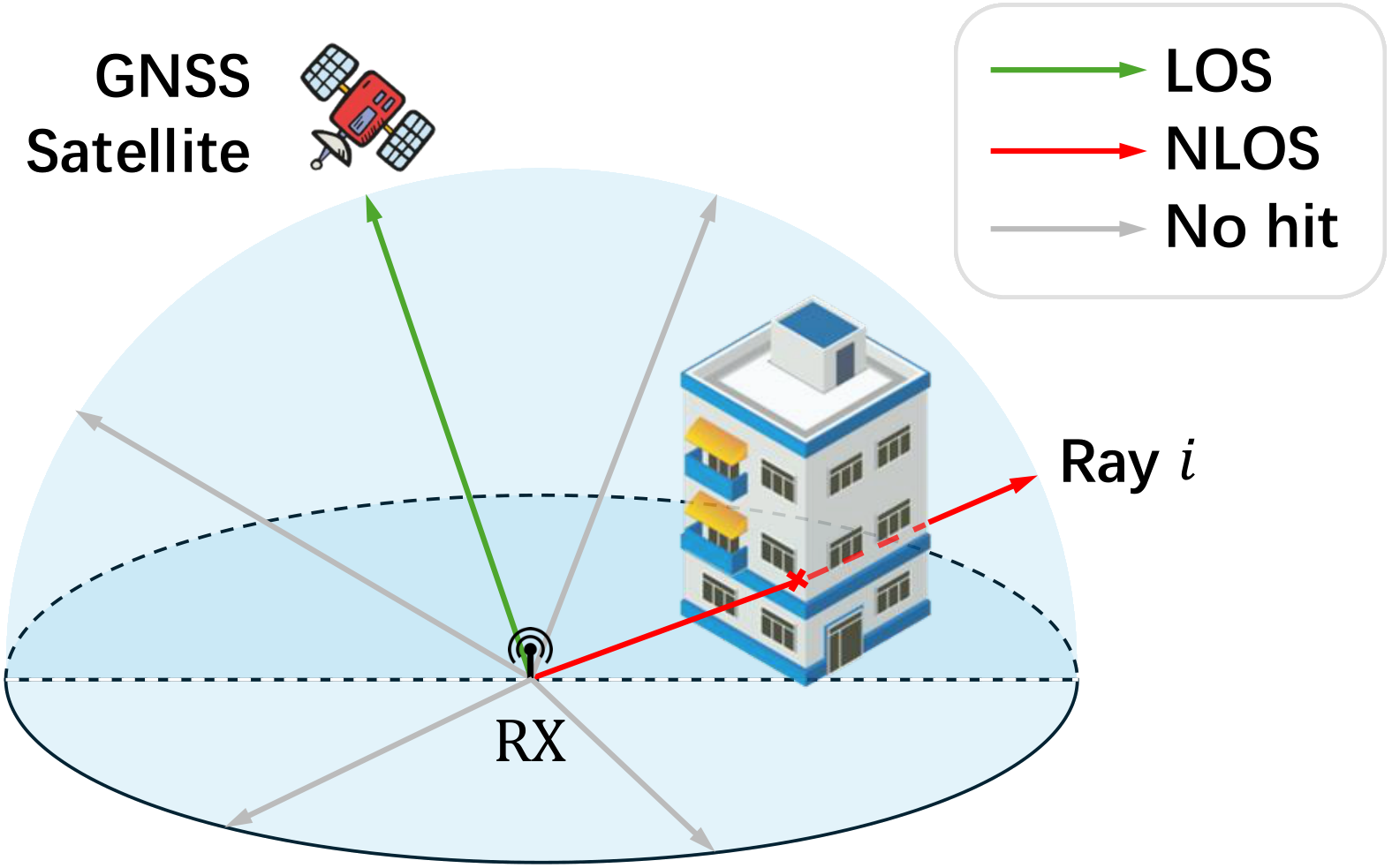
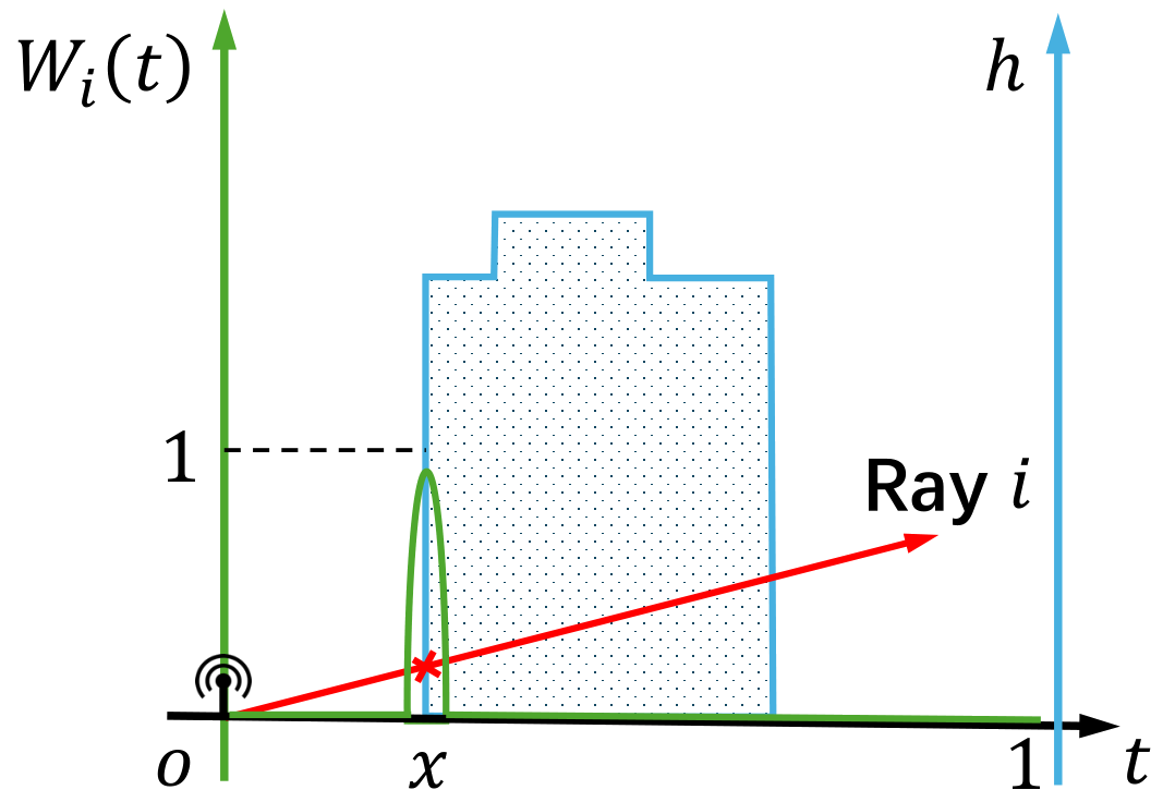
Surface-aware ray sampling. Rays are uniformly cast over the upper hemisphere around the receiver to capture both LOS and NLOS paths. Differentiable surface intersections yield interaction points $\mathbf{x}^{(k)}$ with incident/outgoing directions $(\hat{\omega}_i^{(k)},\hat{\omega}_o^{(k)})$, so geometry can be supervised by scalar received power alone.

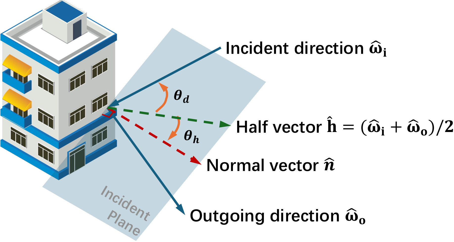
Half-angle parameterization. Signal-surface attenuation is modeled with a Spatially-Varying BRDF under the Rusinkiewicz half-angle parameterization. Reflection depends on the half-vector $\mathbf{h}=(\hat{\omega}_i+\hat{\omega}_o)/2$ through angular terms $(\theta_h,\theta_d)$, which compactly encode specular and diffuse behavior for neural prediction.

Satellite source modeling
Satellite source as a plane wave with parallel incident rays.
Surface-aware ray sampling
Surface-aware ray sampling over the upper hemisphere.
Differentiable surface sampling weights
Differentiable surface sampling weights along each ray.
Half-vector encoding
Rusinkiewicz half-angle parameterization for BRDF.

Surface-Aware Rendering

SurfNeHF combines ray sampling and surface-aware attenuation into a differentiable RF renderer. Sampled surface interactions are processed by NeHF (geometry/normal), a Shadow Renderer (visibility), and a Neural BRDF (reflectivity), then aggregated into received power $P^{\mathrm{rx}}$.

Each intersection $\mathbf{x}^{(k)}$ yields a surface normal $\hat{\mathbf{n}}^{(k)}$ from NeHF. Conditioned on $(\mathbf{x}^{(k)},\hat{\omega}_i^{(k)},\hat{\omega}_o^{(k)})$, the BRDF network predicts reflectivity $f_r^{(k)}$, while the shadow renderer estimates visibility $v^{(k)}$. LOS and NLOS contributions are unified in the RF-domain power expression, enabling end-to-end learning of geometry and reflectance from crowdsourced GNSS measurements.

Neural network architecture for surface-aware rendering.

Material via Spatially Varying Bidirectional Reflectance Distribution Function (BRDF)

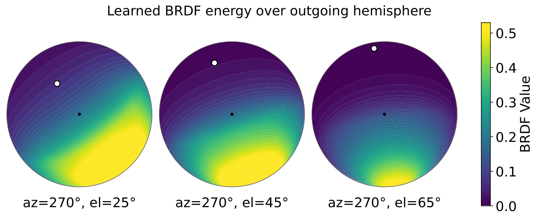
Because city-scale ground-truth materials are unavailable, we assess the learned neural BRDF by physical plausibility. Supervised only by scalar omnidirectional power, the model still recovers anisotropic scattering with specular lobes that move opposite the incident direction as elevation changes, matching brick-wall roughness under the Rayleigh criterion.

Signal-building intersection
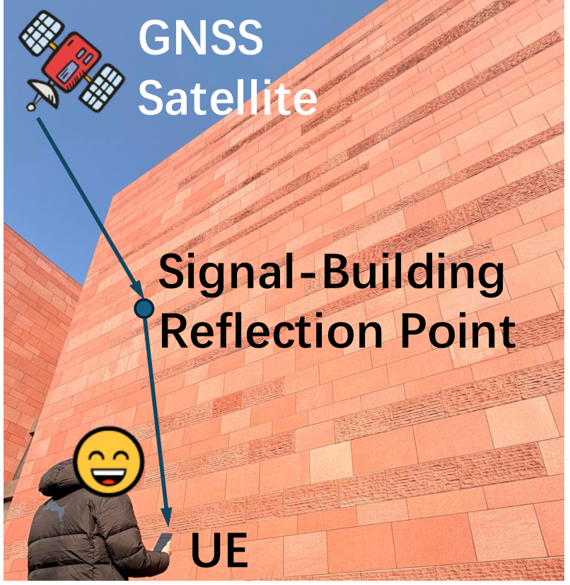
Signal-building intersection during data collection.
Learned BRDF hemisphere maps
Learned BRDF energy over the outgoing hemisphere at different incident elevations.

Complex Building Surface Reconstruction Results

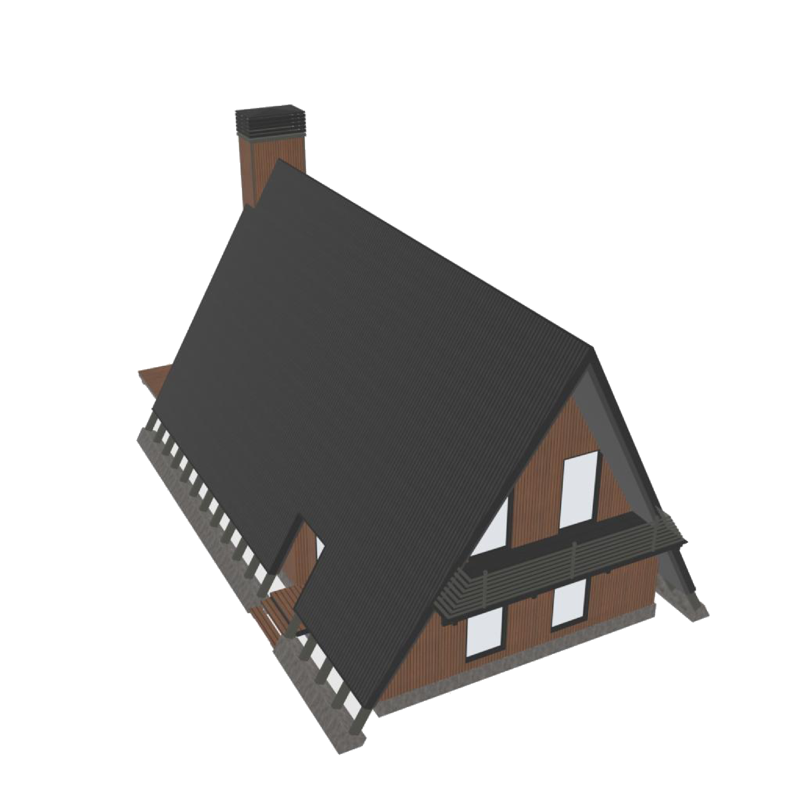
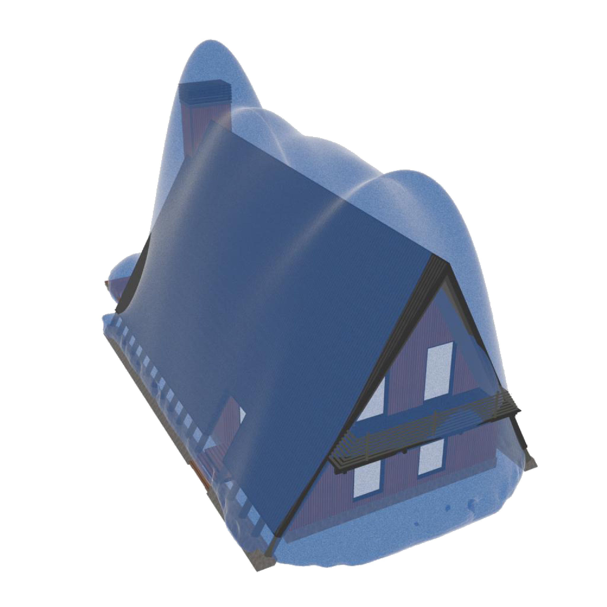
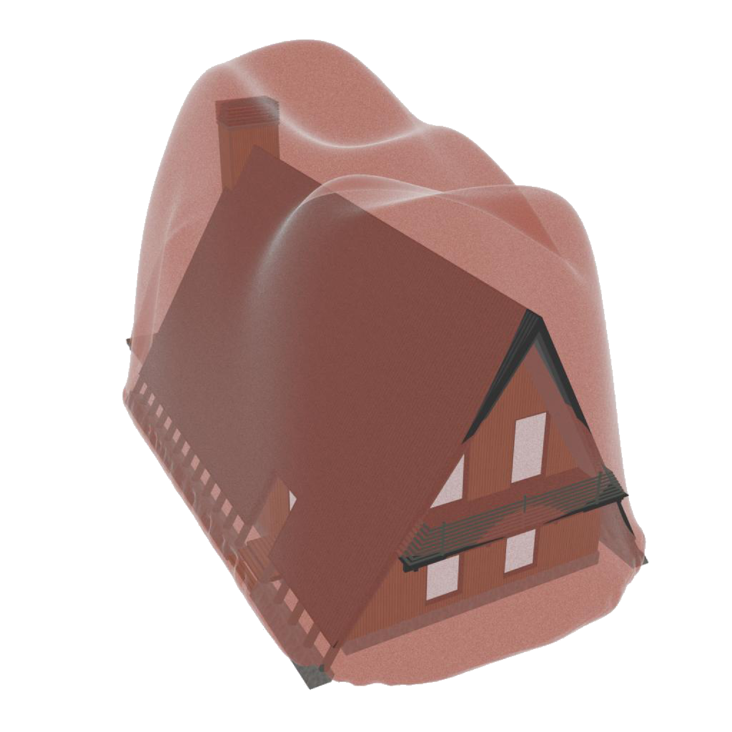
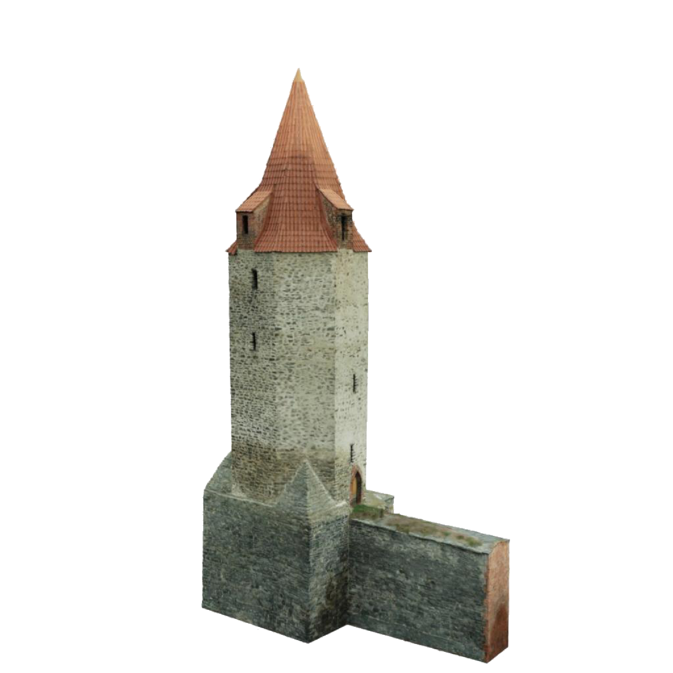
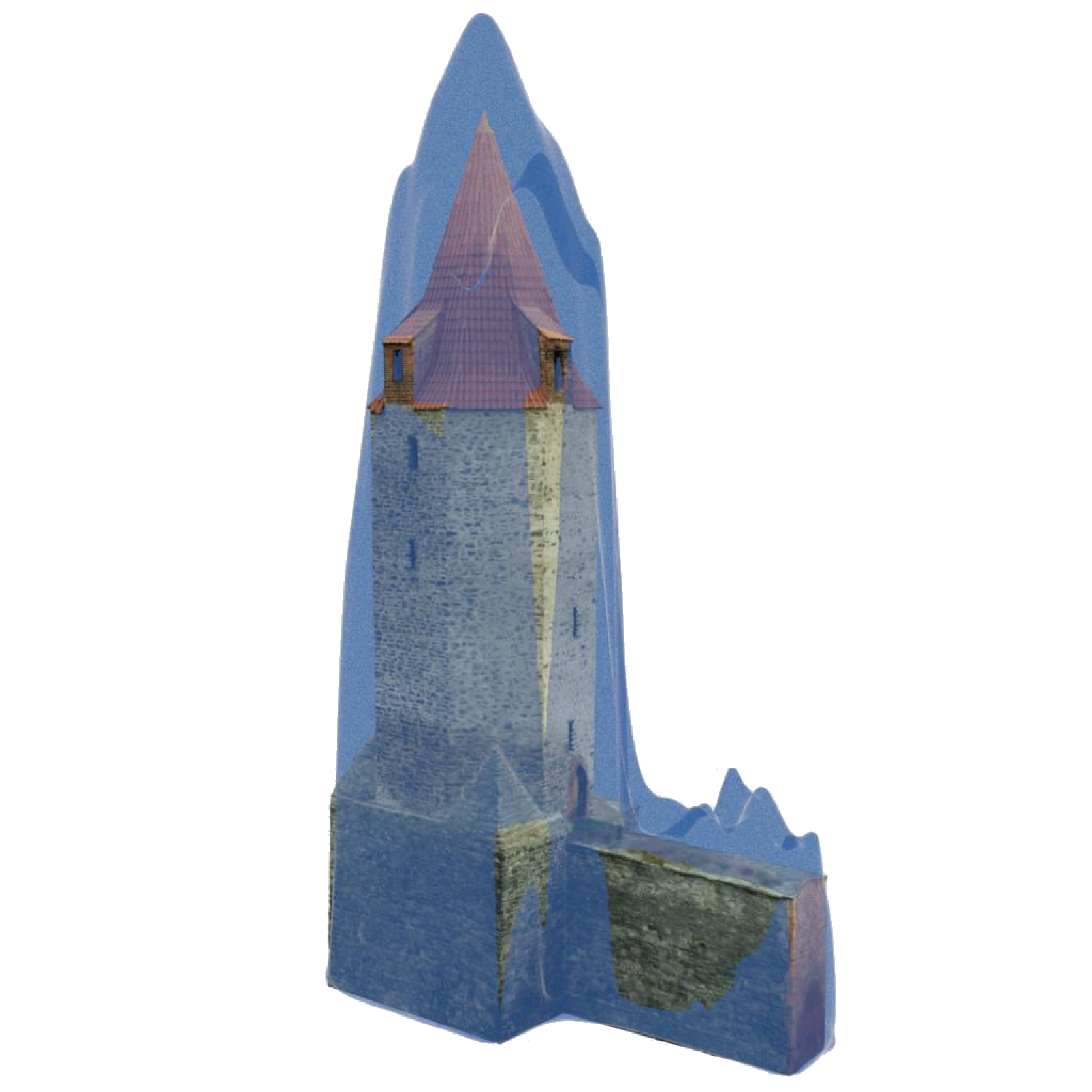
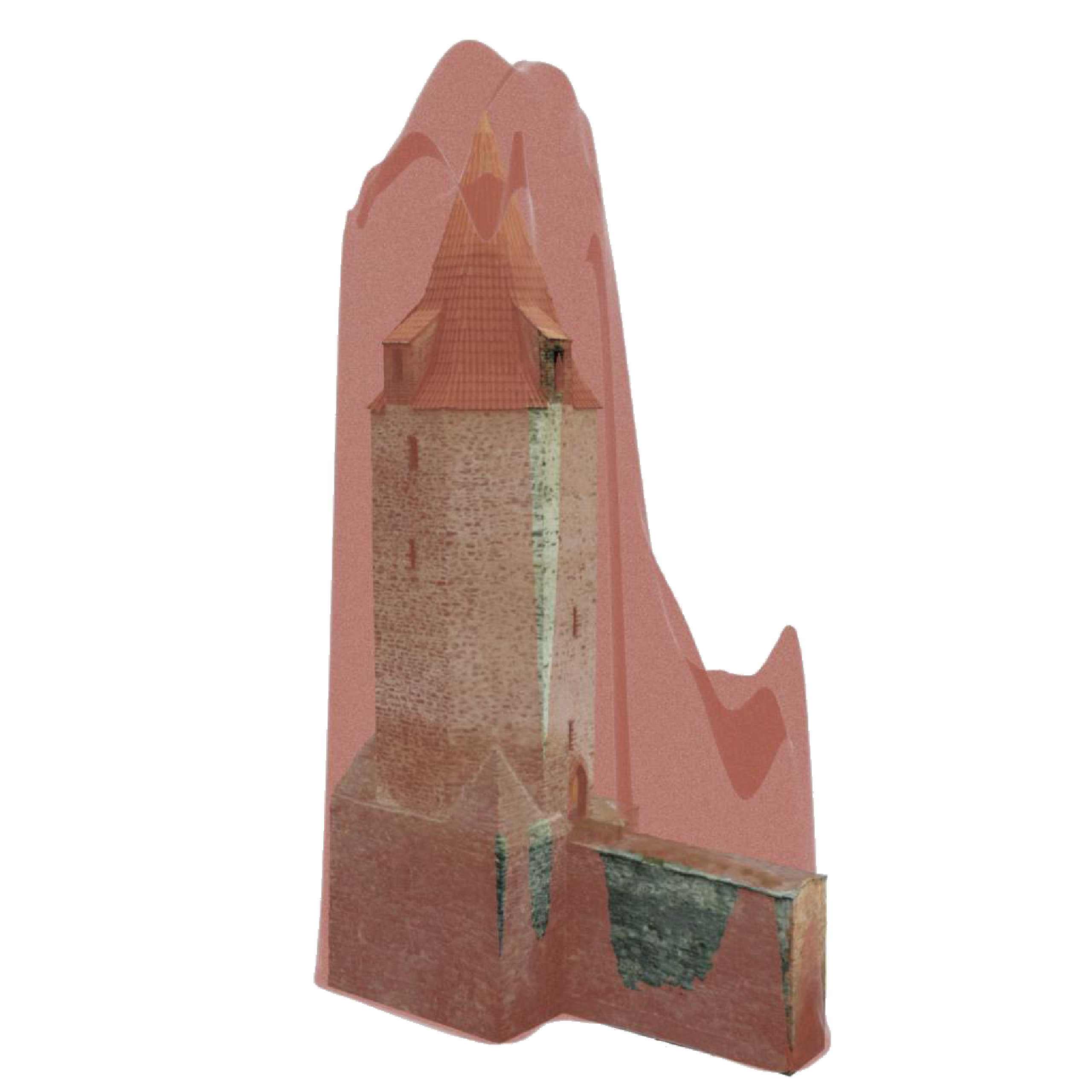
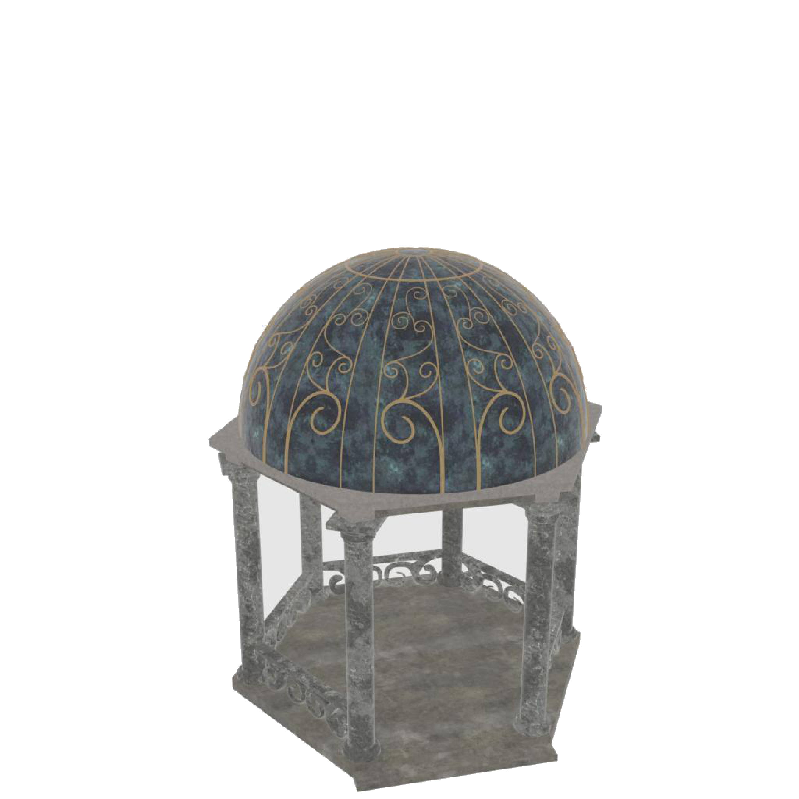
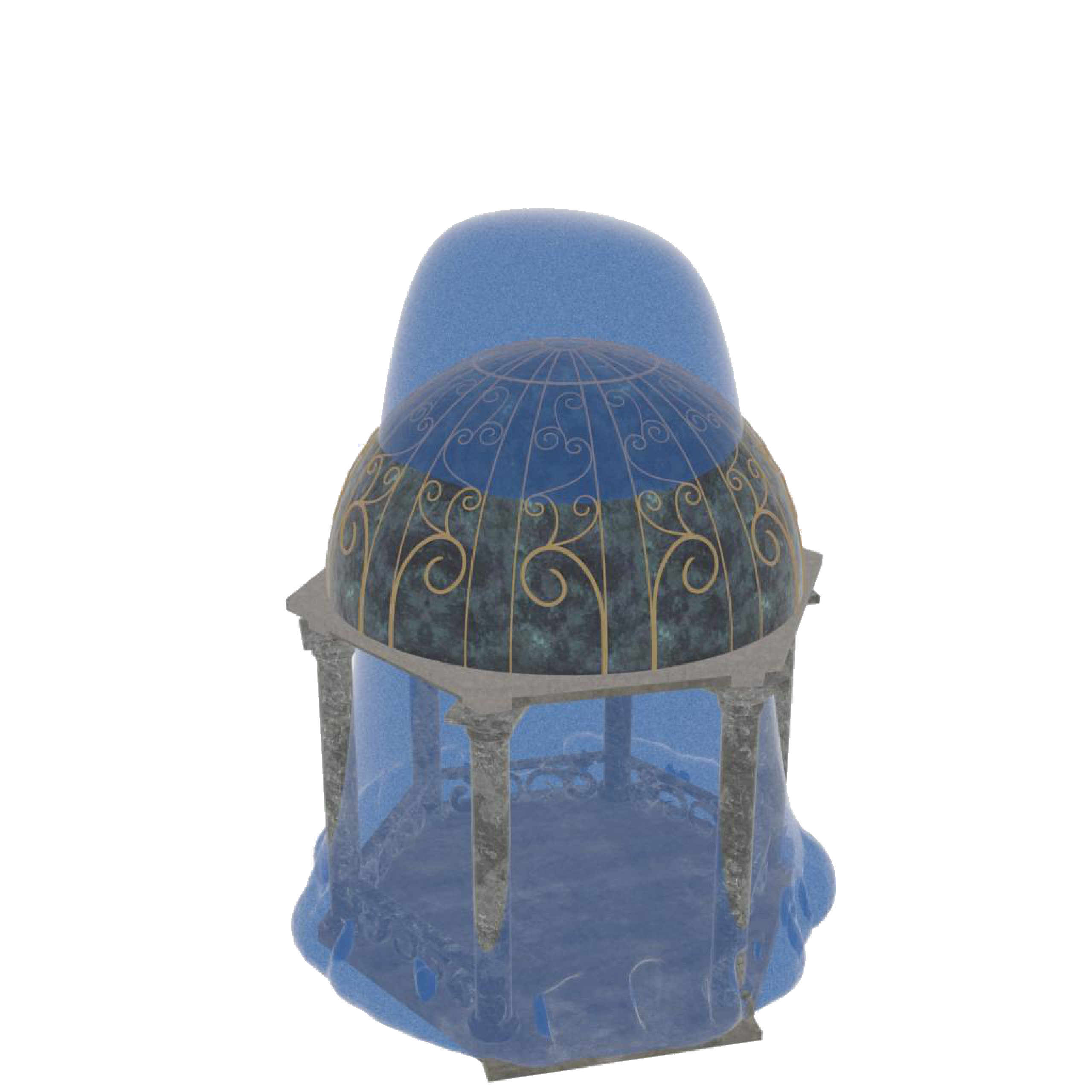
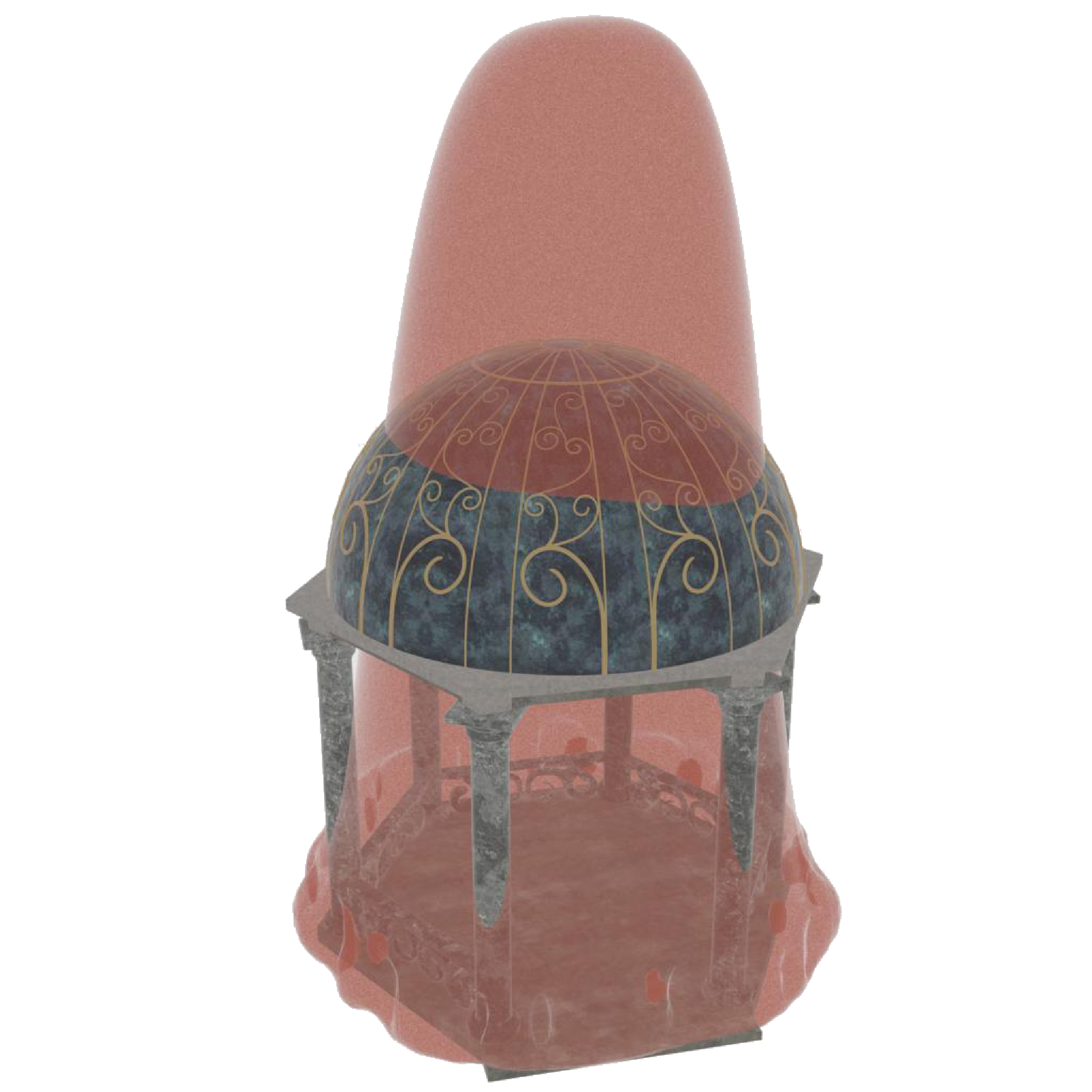
Controlled study on synthetic GNSS-like measurements: an A-frame house with steep ridges, a Tower with spike-like features, and a round-domed Temple with overhangs. Columns show ground truth, reconstruction under clear-sky conditions, and reconstruction in deep urban environments.

A-frame
A-frame ground truth
Ground Truth
A-frame reconstruction under clear-sky conditions
Clear Sky
A-frame reconstruction in a deep urban environment
Deep Urban
Tower
Tower ground truth
Ground Truth
Tower reconstruction under clear-sky conditions
Clear Sky
Tower reconstruction in a deep urban environment
Deep Urban
Temple
Temple ground truth
Ground Truth
Temple reconstruction under clear-sky conditions
Clear Sky
Temple reconstruction in a deep urban environment
Deep Urban

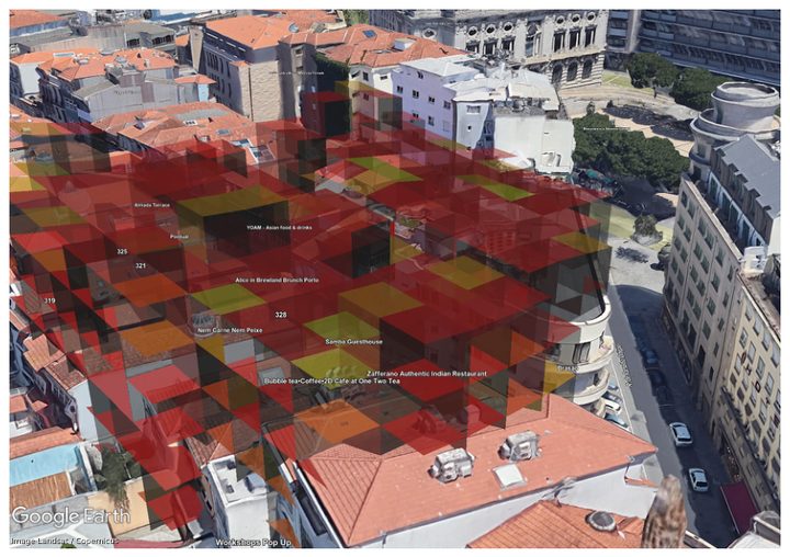
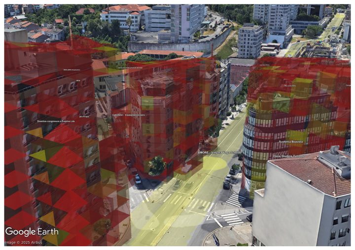
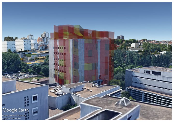
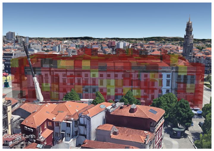
Real-World City Voxel Reconstruction Results

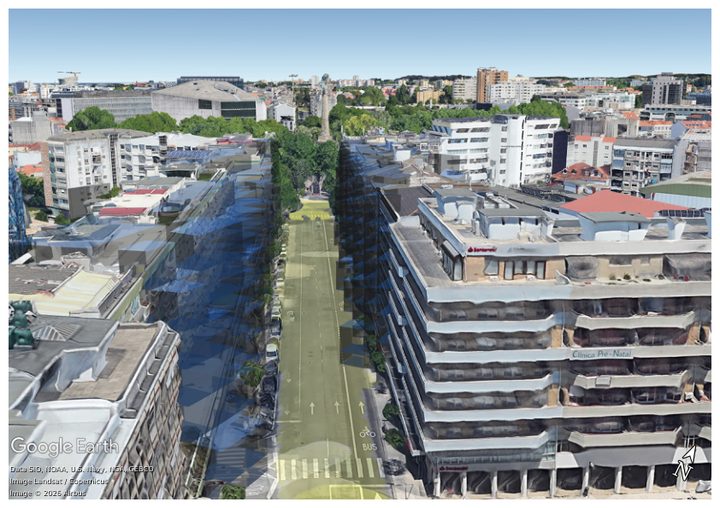
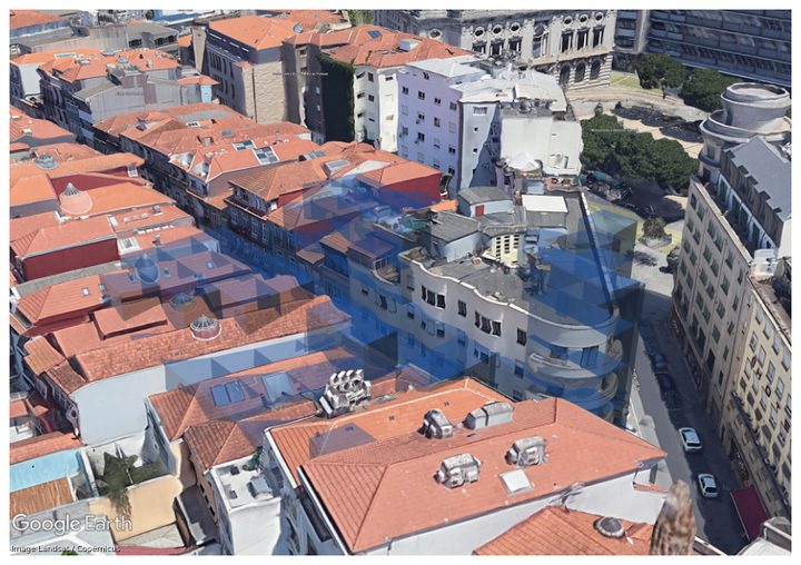
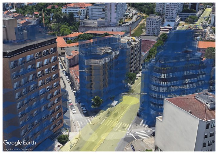
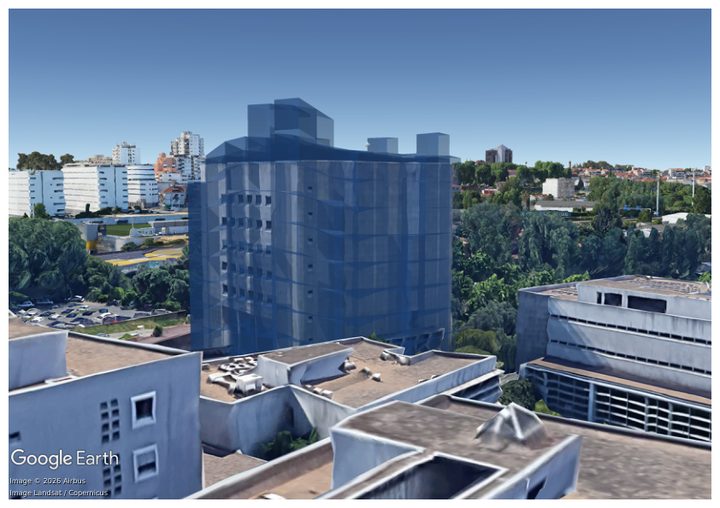
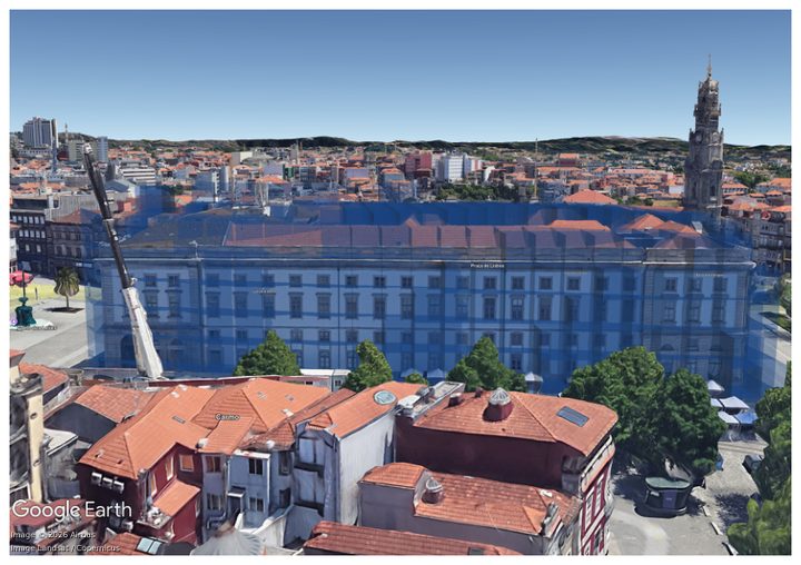
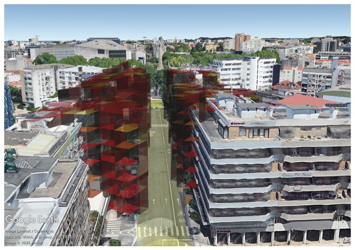
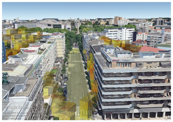
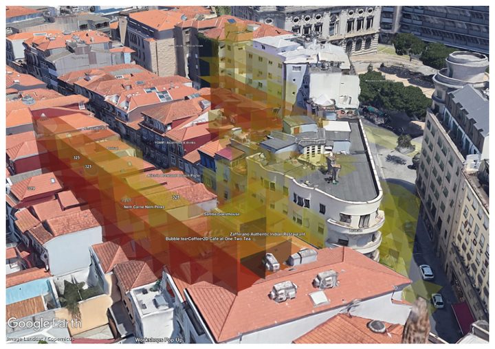
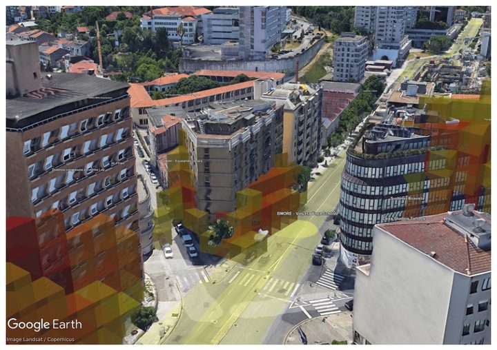
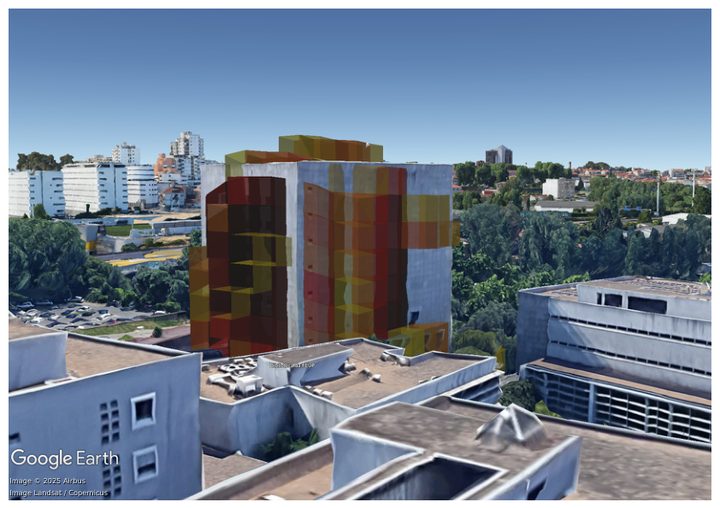
Qualitative results on five open-sourced urban scenes from Avenue to Rectory. Rows compare SurfNeHF, SaRF, and SenseMyCity over Google Earth backgrounds.

Avenue
Canyon
Intersection
Library
Rectory
SurfNeHF
(Ours)
SaRF
SenseMyCity
avenue SurfNeHF
canyon SurfNeHF
intersection SurfNeHF
library SurfNeHF
rectory SurfNeHF
avenue SaRF
canyon SaRF
intersection SaRF
library SaRF
rectory SaRF
avenue SenseMyCity
canyon SenseMyCity
intersection SenseMyCity
library SenseMyCity
rectory SenseMyCity

Citation

surfnehf ยท ubicomp '26
@article{jia2026surfnehf,
  title={SurfNeHF: Surface-Aware Neural Height Fields for Efficient 3D Urban Mapping Using Crowdsourced GNSS Data},
  author={Jia, Haifeng and Ding, Xingyuan and Qu, Minyang and Pi, Yibo and Chen, Cailian},
  journal={Proceedings of the ACM on Interactive, Mobile, Wearable and Ubiquitous Technologies},
  volume={10},
  number={2},
  pages={1--31},
  year={2026},
  publisher={ACM New York, NY, USA}
}
โ† Back to homepage